
The Dragon and the St Michael Churches
In legend, Radnor forest is the place of the last dragon in Wales, and it sleeps. Roundabout the forest are five St Michael Churches which supposedly control or contain the dragon. All are built on ancient mounds and surrounded by yew trees. They are (anticlockwise):
Cascob (North-East)- It’s near where John Dee’s family came from (see below), and a magic spell was found in the churchyard and now hangs in the church. There’s also a special fluted yew tree there.

Rhydithon (North) – on the A488, didn’t seem too interesting. https://www.jlb2011.co.uk/walespic/churches/llanfihangelrhyd1.htm
Cefnllys (North-West), near Llandidrod Wells, now isolated without any road access – https://www.britainexpress.com/wales/mid/llanfihangel-cefnllys-church.htm
Nant Melan (South), near the A44. It was handed to the Knights of St John, and is built on the same plan as Kilpeck Church in Herefordshire. https://cpat.org.uk/Archive/churches/radnor/16855.htm
Discoed (East) has a very ancient yew tree, dated at 5000 years old. I want to visit it! https://www.britainexpress.com/wales/mid/discoed-st-michael.htm
John Dee
As mentioned above, John Dee has a connection with Cascob Church. See also https://www.radnorfforest.co.uk/news-views/legands which says
The Welsh grandfather of Elizabeth I’s advisor, Dr. John Dee, purchased the estate of Nantygroes which Dr. Dee continued to maintain and visit. Nantygroes is relatively close to Llanfihangel Cascob, as the crow flies. It’s interesting to note that ”Dee claimed descent from Llewelyn Crugeryr, a thirteenth-century chieftain whose Castell Crugeryr mound can still be seen by the A44 just west of the Fforest Inn.” (The Folklore of Radnorshire © Roy Palmer 2001, pg. 105; Logaston Press 2007).
Nant-y-Groes is in the Lugg River valley on the B4356 near Pilleth. See https://coflein.gov.uk/en/site/30849/
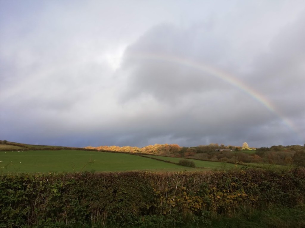
Here’s a picture of a rainbow over the hill behind Nantygroes:
Walton Basin Area
The Walton Basin is on the south east side of Radnor Forest (around Evenjobb), and there was a lot going on in this area in the Neolithic period, including the largest prehistoric timber enclosure in Britain!
https://cpat.org.uk/wp-content/uploads/2018/12/How-the-West-was-Won-Panel-1.pdf
Particular items include:
Hindwell Enclosure Timber Circle
This large timber enclosure was just south of Evenjobb. Nothing to see now I don’t think, but the road pattern follows the outline of the (huge) enclosure.
https://www.megalithic.co.uk/article.php?sid=19715
Four Stones Circle
This is a nice little circle of four stones, just inside a field by the road.
https://www.megalithic.co.uk/article.php?sid=349

Whimble Hill and the Mystery Hill!
There is a barrow, 19m in diameter and 1.2m high, set upon Whimble, a conical hill, and it has a more recent cairn, 11m in diameter and 0.6m high, superimposed upon it.
https://www.megalithic.co.uk/article.php?sid=34221
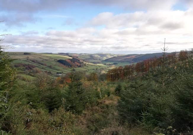
Now… There’s a hill which dominates the view from the East. Here’s a picture taken from the road through Evenjobb, showing a rounded hill poking up in Radnor Forest. It seems significant that is overlooks the whole of the basin. Is it Whimble Hill? What do you think? Whatever it is it make me think the dragon is somewhere there! I want to explore there some more!

